Nitrate Vulnerable Zones - Maps  


Nitrate Vulnerable Zones (England 2009) – as amended May 2010 pursuant to Regulation 10 of the Nitrate Pollution Prevention Regulations 2008
 

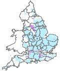
This website provides access to detailed maps of the current Nitrate Vulnerable Zones (NVZs) in England which show the NVZ boundary matched to individual field boundaries.

Full details of the Action Programme measures, with which farmers located in these NVZs need to comply, are available on the DEFRA NVZ Home


  Regional Maps  
 

Click here to view regional maps 


View the regional maps.

 
  In order to view these maps you require Adobe Acrobat Reader Version 5 or higher to be installed on your computer.  If you have version 9 installed and maps are slow to appear then click here for advice.

 
  Download Adobe Acrobat Reader  
Summary Maps
In addition to the regional maps summary maps of the whole of England are available.
England - A4 map (PDF) 1300 kb
England - A3 map (PDF) 1000 kb
An ESRI Shapfile of the current NVZ boundary is now also available.
England - ESRI Shapefile - 25/01/2011 (16.4MB)