Nitrate Vulnerable Zones - Maps  


DEFRA NVZ Home


Regional Maps
 

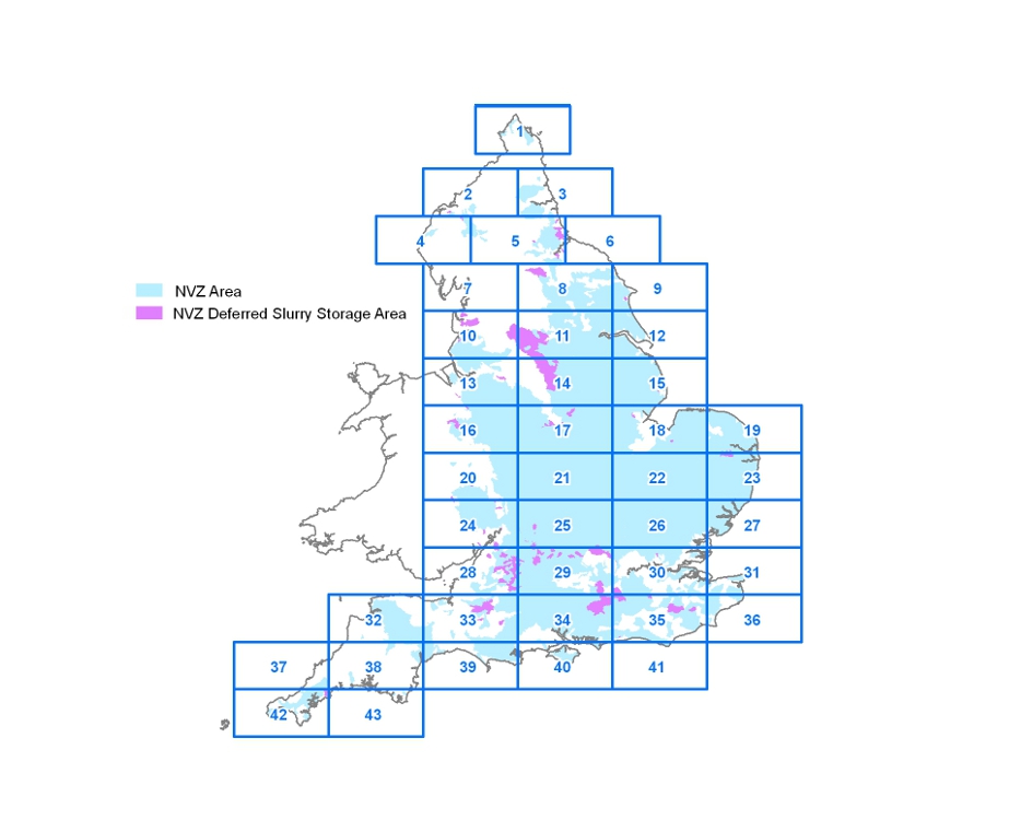
Please choose a part of England to view maps of the NVZs.

The Nitrates Directive requires all known areas of land which drain into polluted waters to be designated as NVZs. Polluted waters are defined as follows.

(a) Surface freshwaters which contain or could contain, if preventative action is not taken, nitrate concentrations greater than 50 milligrammes per litre (mg/l).

(b) Groundwaters which contain or could contain, if preventative action is not taken, nitrate concentrations greater than 50mg/l.

(c) Natural freshwater lakes, or other freshwater bodies, estuaries, coastal waters and marine waters which are eutrophic or may become so in the near future if preventative action is not taken.

For a full explanation of the steps taken to identify the new NVZs in England please refer to the Defra NVZ web pages.


Part 43.html Part 42.html Part 41.html Part 40.html Part 39.html Part 38.html Part 37.html Part 36.html Part 35.html Part 34.html Part 33.html Part 32.html Part 31.html Part 30.html Part 29.html Part 28.html Part 27.html Part 26.html Part 25.html Part 24.html Part 23.html Part 22.html Part 21.html Part 20.html Part 19.html Part 18.html Part 17.html Part 16.html Part 15.html Part 14.html Part 13.html Part 12.html Part 11.html Part 10.html Part 9.html Part 8.html Part 7.html Part 6.html Part 5.html Part 4.html Part 3.html Part 2.html Part 1.html Map